

Flowing through downtown Chicago, the river that bears the name of the city has an interesting history. Once a corridor of commercial activity, the river has been transformed into a recreational area with sightseeing boats and kayaks. Along the banks are pedestrian friendly promenades lined with café’s and eateries.
The Early River
The banks of the 156-mile-long (251 km) Chicago River were the chosen location for most Illini and Miami Indian Tribes who settled in America’s Midwest. When colonization began, others chose the area near the river as their desired location as well.
Changing the Flow
In 1900, engineers accomplished what was considered one of the most remarkable feats of the early twentieth century. They reversed the direction of the Chicago River. The river originally flowed into Lake Michigan.
That was bad news for those who desired clean drinking water, as the direction of the flow allowed sewage and other debris to be carried into the city’s water source. Diseases, caused by unsanitary water, were rampant in the city. To improve the situation, those in charge constructed a series of canal locks that allowed the river to flow into the newly built Chicago Sanitary and Ship Canal, providing cleaner drinking water.
People living along the river upstream were not so thrilled, however, since they now lived near Chicago’s drainpipe.
During the 1960s people started to become more environmentally aware which led to the efforts from the city to reduce pollution. Ever since the start of the 1970s, when the Clean Water Act set a goal of making the rivers ‘fishable and swimmable’ the quality of the water in the Chicago River has gradually improved.
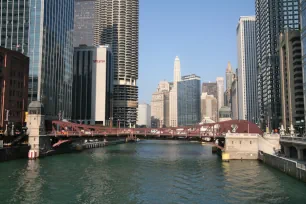
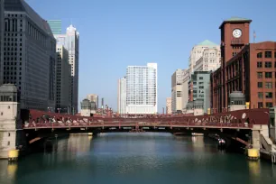
Bridges
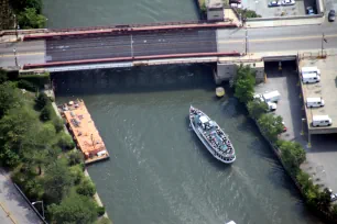
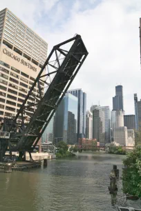
Throughout the city and its nearby suburbs, forty-five movable bridges span the river, many of them well-known and quite picturesque. Several were also considered engineering marvels of their time, like the one at Michigan Avenue, one of the first fixed trunnion bascule bridges in the country, built in 1920.
River cruises
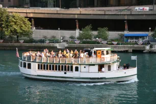
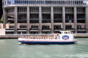
Many of Chicago’s greatest buildings border the Chicago river, making the river ideal for architectural boat tours. There are several popular river cruises you can choose from. Most either start near the Michigan Avenue Bridge or Navy Pier.
Here are some links to tour boat operators:
DuSable Founder’s Way
When developers proposed a shopping center at the River East Center near the Chicago River, the city approved the project on the condition that the developers would leave an area along the Chicago river between DuSable Park and Pioneer Court on Michigan Avenue to the Chicago Park District.
In 1988 the Park District turned the area into a promenade, known as the River Esplanade, later renamed to DuSable Founder’s Way, after Jean Baptiste Pointe du Sable who is known as the Founder of Chicago.
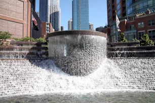
Centennial Fountain
The Centennial Fountain, located at a plaza on the River Esplanade, was built in 1989 to celebrate the reversal of the flow of the Chicago River.
The fountain, which is officially known as the Nicholas J. Melas Centennial Fountain, consists of a waterfall and a semicircular cascade. During summer months, at the hour for ten minutes, the fountain shoots a large water arc into the river.
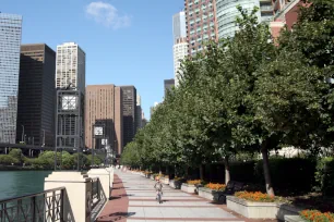
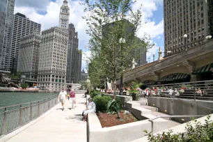
Riverwalk
In 1999 Chicago’s mayor Richard M. Daley initiated a project to turn Chicago’s riverfront – at that time mostly inaccessible to the public – into a public walkway known as the Riverwalk.
The Riverwalk opened gradually over the years, each time expanding the riverfront area to more visitors and residents. The first completed section, on the south bank of the river between Michigan Avenue and Wabash Street, opened in 2005. The second section, from Wabash to State Street, opened just four years later. The last sections opened in 2016. Today there is a green corridor along the river spanning from West Lake Street all the way to Michigan Lake. Several café’s line the popular walkway, and you can find attractions such as boat cruises and water taxis along the way.
- Next: Tribune Tower
- More Sights & Attractions in Chicago